Loading...
Please wait for a bit
Please wait for a bit
Click any word to translate
Original article by Guardian staff and agency
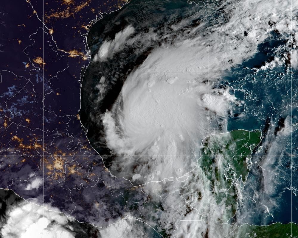
Tropical Storm Isaias formed early on Wednesday in the warm waters off eastern Mexico and forecasters said it was expected to strengthen into the first hurricane of the belated Atlantic season, as early as Thursday, before hitting the US Gulf coast later in the week.
Isaias succeeded Tropical Depression Nine as it strengthened overnight. It was located about 285 miles (460km) west of Progreso, Mexico, and about 580 miles south-west of where the Mississippi River spills into the Gulf of Mexico in Louisiana, according to the National Hurricane Center (NHC). The storm on Wednesday morning had maximum sustained winds of 40mph (65km/h) and was moving east to north-east at 8mph.
The first hurricane of the Atlantic season has not formed this late since 8 October 1905.
Communities in the potential path of Isaias moved quickly to prepare for landfall, forecast as soon as Friday evening.
Some Gulf oil wells paused production and an Alabama beach city canceled a weekend festival known to draw thousands of tourists. Florida’s governor declared a state of emergency for more than one-third of the state’s counties.
Isaias could become a major category 3 hurricane, with winds of 111mph (178 km/h) or stronger, before it strikes land, said Michael Brennan, director of the NHC.
“We’re expecting multiple dangerous, life-threatening impacts along portions of the northern Gulf Coast beginning Friday and continuing into the weekend,” Brennan said in a video briefing Wednesday.
It was not immediately known where the storm may make landfall on the US Gulf coast. The NHC issued a hurricane watch from Bay St Louis, Mississippi, to Indian Pass, Florida. The watch means hurricane conditions are possible within 48 hours.
The hurricane center’s initial projections said the center of Isaias could come onshore somewhere between eastern Louisiana and the western Florida Panhandle. People in those areas were urged to prepare for the storm.
“There is an increasing risk of dangerous wind and storm surge impacts along portions of the northern Gulf Coast,” the hurricane center, based in Miami, Florida, said. “Residents from Louisiana to the Florida Panhandle should closely monitor the latest forecast updates and ensure they have their hurricane plan in place.”
Forecasters added that there was “uncertainty in where the system makes the northeast turn and how fast it moves toward the coast”. The direction of the storm could see it make landfall where Alabama meets Florida early on Saturday, but the NHC reiterated that the exact path was uncertain.
In Gulf Shores, Alabama, the storm threat caused organizers to cancel the National Shrimp Festival that had been scheduled for Thursday through the weekend. The event drew an estimated 325,000 people last year.
The storm comes as the Atlantic hurricane season has been unusually quiet this year owing to a particularly strong El Niño, which disrupts storm formation over that ocean. Storm activity in the Pacific has been above average.
This year’s huge El Niño is causing climate chaos around the world. Temperate records have already been broken, with extreme heat reported from western Europe to California. Meanwhile, Bangkok is suffering massive flooding and the weather phenomenon is projected to cause a further 450,000 deaths globally by February.
The Associated Press contributed reporting